
GpsCamera: Geotag Every Photo, Exactly — a Native Android GPS Camera
A fast, native Android camera that burns your exact location and a live mini-map onto every photo, writes standards-compliant GPS EXIF, and files each shot into its own album. Trustworthy documentation as a tool for good.
Part of the #AI4Good series — one app a day, each built for good.
Not everything that does good is glamorous. Sometimes it’s a field engineer proving they inspected a transformer, a surveyor documenting flood damage, or a community reporter capturing a pothole with a location no one can dispute. They all need the same thing: a photo you can trust.
What it is
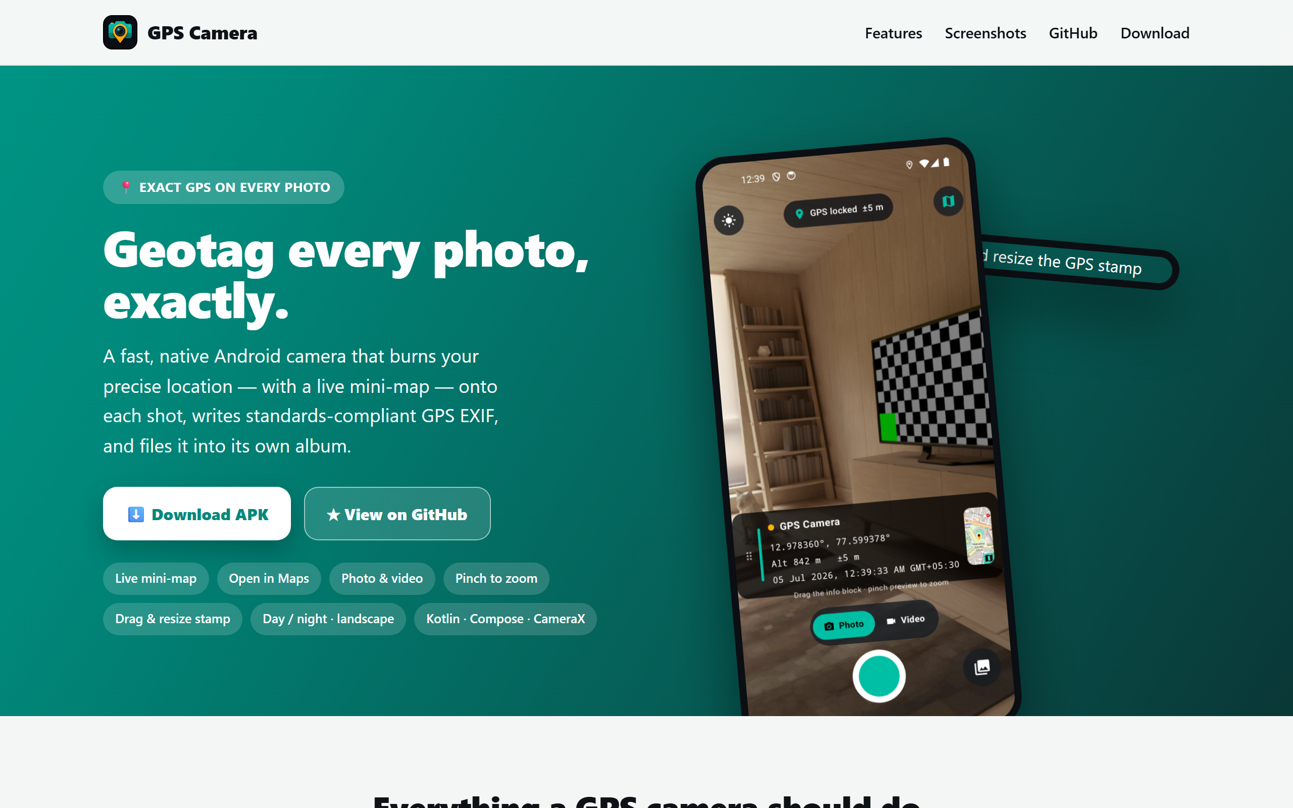
GpsCamera is a fast, native Android camera that makes every shot verifiable. Straight from the live site:
- Geotagged capture — every photo is stamped with the reverse-geocoded address, decimal coordinates, altitude, accuracy and a timestamp.
- Live mini-map — a real OpenStreetMap thumbnail of your exact spot, shown live on the viewfinder and burned onto the shot.
- Open in Maps — tap the map (or the link embedded in the photo) to jump straight to the coordinates in Google Maps.
- Photo & video, pinch-to-zoom, and a full-screen gallery (swipe, pinch-zoom, open-in-Maps from EXIF, share).
- Move & resize the stamp — drag the info block anywhere and pinch to resize before you shoot; it’s burned exactly as arranged.
- Standards-compliant EXIF — GPS lat/lon/alt/timestamp + a clickable Maps URL written into the JPEG, so Google Photos and Lightroom place it on a map automatically.
- Day & night themes, portrait and landscape reflow, and a dedicated
Pictures/GPSCameraalbum.
How it was built
GpsCamera is deliberately native and dependency-light — Kotlin + Jetpack Compose (Material 3) + CameraX, min/target SDK 26/35, no heavyweight frameworks. The engineering value is in a few careful choices:
- Resilient location. It merges Google Play Services fused location and the platform GPS/network providers, so it still works on devices without Google Play Services — exactly the rural/field scenarios it’s built for.
- No-API-key maps. The mini-map is stitched from OpenStreetMap raster tiles with pure web-mercator (“slippy map”) tile math — no Maps SDK, no key, no quota.
StaticMapProviderfetches and stitches the tiles and draws the pin;PhotoStamperburns the info panel + map onto the bitmap. - Testable core. The tricky bits are pure, unit-tested Kotlin —
GpsFormat(DMS / EXIF-rational / stamp text) andSlippyMap(tile math + Maps URLs) — plus on-device instrumented tests for what can only be verified for real:ExifWriter(EXIF read-back),PhotoStamper, andPhotoSaver(MediaStore storage). - Clean module split:
model/GeoFix·location/LocationRepository(fused + platform + reverse geocoding) ·map/StaticMapProvider·camera/{PhotoStamper, ExifWriter, PhotoSaver, GalleryRepository}· Composeui/. The app icon itself was generated with Azure AI Foundrygpt-image-2.
The good
A timestamped, geotagged, tamper-evident photo is a small piece of infrastructure for accountability — for insurance, field work, journalism, and public services. That it works without Google Play Services or a Maps API key means it reaches exactly the low-connectivity places that need proof the most. Trust is a public good, and GpsCamera hands it to anyone, free.
Try it
- ▶️ Live site: naveenneog.github.io/GpsCamera
- 📦 Download the APK: latest release
- 💻 Source: github.com/naveenneog/GpsCamera
Previous → NeoFit · Next → The Lamp & the Machine. #AI4Good